

Orange County — Post-Tropical Storm Rachel landed in northern Baja California overnight, generating waves expected to produce life-threatening surf and rip current conditions along the coast of Southern California and worsen already devastating coastal flooding and erosion. The storm was about 255 miles north-northeast of San Diego by 8 a.m. Sunday and was expected to dissipate as it continued marching inland, according to the National Hurricane Center
Still, moderate to major coastal flooding is expected along the coasts of Baja and Southern California. • Preparation: In Rachel’s path, Southern Californians scramble to protect homes Destructive flooding and tides have already ripped through coastal communities in Los Angeles and Orange counties. In Long Beach on Saturday, eight structures were red-tagged as unsafe for entry and one yellow-tagged for moderate damage as tides slammed into coastal structures.
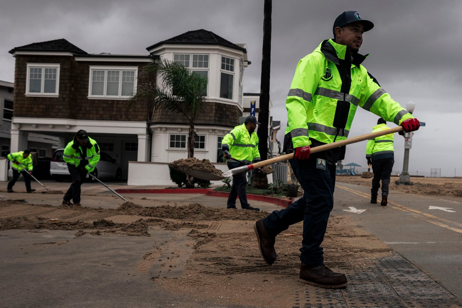
Officials issued mandatory evacuation orders for some residents in the city’s peninsula through Tuesday and were scrambling to fashion a barrier between tides and seaside homes with 50,000 to 100,000 cubic yards of sand on the peninsula. In Newport Beach, flooding prompted officials to declare a local emergency. High tides washed out more than a dozen blocks on Newport Beach’s Balboa Peninsula, flooding cars and forcing pedestrians to slosh through the waters.
Balboa and Newport piers were closed
Balboa and Newport piers were closed. On Sunday, high tide arrived around 9:50 a.m. for Newport Beach and Long Beach. The Los Angeles County National Weather Service forecasted high tides to reach around 8 feet, which would approach or even exceed recent record tide levels for the region. Residents and visitors gathered on Newport Beach’s main pier to watch the large waves during high tide Sunday morning.
A massive berm the city built along the beach largely protected the waves from getting past the sand and into residential areas.Some puddles formed in the parking lot by the beach, but as of just before 10 a.m., water had not reached homes. Brad Rosten, who has lived on Newport Beach’s Balboa Peninsula for 12 years, called his morning walk to the pier “sightseeing.” Rosten said large waves and floods happen “from time to time” in Newport Beach, and the big waves Sunday didn’t seem like much to worry about.
“It’s just another day,” said Rosten, who lives on the side of the peninsula farthest from the ocean. “I’m kind of hanging out to see what happens. But otherwise, just another day as usual.” As of Sunday afternoon, coastal areas of Southern California appeared to avoid the major coastal flooding that was feared. Water levels at 10 a.m. were about 5 inches below the potentially record-breaking high tides that the weather service warned.
Waves were getting larger in the late morning,
Waves were getting larger in the late morning, but did not seem to be as dramatic as Friday’s swell. A possible explanation was the interval between the waves. Laguna Beach resident Kurt Mahoney goes for a swim in the ocean “every day, year round,” but he hasn’t gone since Wednesday because of the waves. Even though the waves weren’t causing major damage Sunday, Mahoney, a 42-year Laguna Beach resident, said they were out of the ordinary.
He called them “rowdy” and “nasty,” pointing to distant waves that were bashing rocks right below a row of apartment buildings. Still, Post-Tropical Storm Rachel was nothing like the El Niño of the early 1990s — at least not yet. Downtown Laguna Beach flooded like a river back then, he said. “It seems like we’re going to be in for it this year, which is a drag,” he said.
The only upside of El Niño, he said, is that the ocean is nice and warm when he goes for his daily swim. On Friday, waves in Long Beach were separated by more than 20 seconds, but on Sunday that period had decreased to 15 seconds. According to the Coastal Data Information Program at UC San Diego Scripps Institution of Oceanography, “short-period wave components lose their energy more readily than long-period components.” The storm brought extraordinary amounts of rainfall to parts of Southern California, including the drought-plagued lower Colorado River Basin.
Blythe (Riverside County), near the Arizona border, measured
Blythe (Riverside County), near the Arizona border, measured 2.8 inches of rain. It was the wettest storm there since 1965. Localized flash flood warnings were issued from Orange County to Death Valley to Las Vegas. Las Vegas recorded 1.08 inches of rain, tying a record for the most in a single October day. The heavy rain prompted a closure of Highway 95 along the California-Nevada border and five flood rescues in Kingman, Ariz, according to the weather service
Along Highway 190 in Death Valley, debris and small boulders were reported over the roadway, the weather service said. Palomar Mountain (San Diego County) was exceptionally wet, with a storm total of 5.1 inches and counting as of 10 a.m. Sunday. The San Bernardino Mountains also picked up 2 to 3 inches of rain. After up to 2 inches fell near Riverside’s Palm Desert overnight, large rocks, mud and debris fell over Highway 74 near mile marker 89, according to the weather service.
The California Highway Patrol reported rockslides in mountainous areas in Southern California, but none appeared to be significant. Car crashes were also reported, but it was unclear whether the accidents were connected to the storm. Rainfall totals were lighter along the coast, but still impressive by October standards. San Diego recorded 0.9 of an inch, Oceanside measured 1.4 inches and Palm Springs even picked up 1.2 inches.
Totals quickly fell off to the north,
Totals quickly fell off to the north, with less than a tenth of an inch in most of the Los Angeles metropolitan area. The weather service warned of a marginal (level 1 of 4) to slight (level 2 of 4) risk of flash flooding across Southern California on Sunday. There was a moderate (level 3 of 4) risk in Las Vegas). Locally heavy rain was also expected Monday along the coast from lingering showers.
Wind damage appeared to be limited in coastal areas. The storm’s landfall in Mexico left Southern California on the less-windy side of the low-pressure system. San Diego’s strongest gust was just 36 mph. Desert areas were hit with stronger winds, including some severe-warned thunderstorms for gusts of 60 mph or stronger. A low but nonzero chance of tornadoes remained from roughly Las Vegas to Phoenix through early afternoon, according to the weather service.
Saul Pink reported from Southern California, and Anthony Edwards and Brooke Park from the Bay Area.
